Today was a day of fast highway, quiet country roads and rough tracks in more or less equal measure. There were also some hills added to the mix, expected but not as bad as anticipated. The upshot of that and the generally good roads was that I made better time than expected, reaching my potential camping site by midday. It seemed sensible to alter my plan for the day, to use the afternoon to eat further into the miles, spend tonight in accommodation close to the town I had not expected to reach until tomorrow, and camp tomorrow night instead. Overall things went pretty well, except for the one time when they didn’t.
I left at 7.15am, partly because I was up and ready to go but also because it seemed sensible to get off the three-lane zombie-apocalypse highway out of Ruse as early as possible. As it turned out it was again not that busy, although traffic increased as I approached the exit for the Friendship Bridge and once again there was the row of static lorries leading to the border. I can not help wondering that if this is what happens at the border of two Schengen countries, what are things going to be like back home in the future?
After the junction I was rid of most of the lorries but on a fast dual carriageway for fifteen miles, not crazy busy but with enough traffic to keep me wary, keep me pedaling and make me thankful for the quiet country lanes and tracks that followed. Narrow, well-surfaced roads took me through small villages and a rough track took me alongside the Danube, although other than the very occasional glimpse the river remained out of sight behind a thick wall of trees and shrubs. My route then looped back to the main road, now a single carriageway and much quieter.
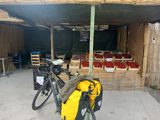
As I entered the village of Nova Cherna I stopped at a roadside fruit stall to buy some strawberries and ended up joining the owner and a couple of his colleagues for a coffee where once again my Spanish proved useful. I should have then gone through the town of Tutraken but missed the turning although picked the route up again shortly after. There then followed the best and the worst part of the day.
Shortly after Tutrakan the route goes through a series of tiny villages. Mostly they are so small they are hardly worthy of the name and the lanes in some cases would be better described as farmer's tracks; packed mud paths cutting their way through woodland and the centre of wheat fields. But it was quiet and peaceful, the tracks were firm and mostly smooth and the villages were nestled into the landscape. It made for beautiful scenery albeit on a rather undulating route.
 |
| Dolno Ryakhovo |
I was then faced with a choice. My gps gave me a route near the river to reach the next town, Srebarna, but the maps I had been lent by the Germans all those weeks ago had that as an alternative route. Their main route rejoined the main road but was seven miles longer. It seemed a 'no brainer' as to which option to take but it turned out to be the wrong decision.
 |
| Malak Preslavets |
 |
| Dolno Ryakhovo |
I turned down the lane to take the shorter route. The concrete road became a solid mud track through farmland, nothing to worry about as I had expected something like this from the map and had already done similar today. I followed the track through crops. It became more ill-defined. I became more dubious. When I checked, I was very slightly off route but there seemed to be nothing where the gps route was indicating a track to be so I pressed on; I was heading in the right direction and my path looked like it might converge with the indicated route further ahead. But further ahead things got worse: I was now in woodland on the flood plain close to the Danube where the firm mud had became softer, sticky and clay like, clinging to bike and wheels in great clods, clogging them, stopping them turning. And I was not getting nearer to that annoyingly close blue line - a few tens of yards away to my right through thick shrub and up a short but steep escarpment - that told me where I was supposed to be. It was obviously time to retrace my steps. It took a lot of effort and a lot of regular mud removal and when I could I went to where the gps told me the route should be: I was in the middle of a crop field. It became clear that wherever the track may have once been, it was no longer there.
Having wasted an hour, I ended up doing those extra seven miles and I am now in a cheap hotel in the small town of Ajdemir. I have eaten well in the restaurant next door and am a lot less muddy than I was earlier. Despite my efforts though, I am not sure I can say the same for my bike.


No comments:
Post a Comment